The Bosporus, is a narrow, natural strait and an internationally significant waterway located in northwestern Turkey. It forms part of the continental boundary between Asia and Europe, and divides Turkey by separating Anatolia from Thrace. It is the world’s narrowest strait used for international navigation. The Bosporus connects the Black Sea with the Sea of Marmara, and, by extension via the Dardanelles, the Aegean and Mediterranean seas, and by the Kerch Strait, the Sea of Azov.
Most of the shores of the strait, except for those in the north, are heavily settled, straddled by the city of Istanbul’s metropolitan population of 17 million inhabitants extending inland from both coasts.
The Bosporus and the Dardanelles are known as the Turkish Straits.


| Item | Value |
|---|---|
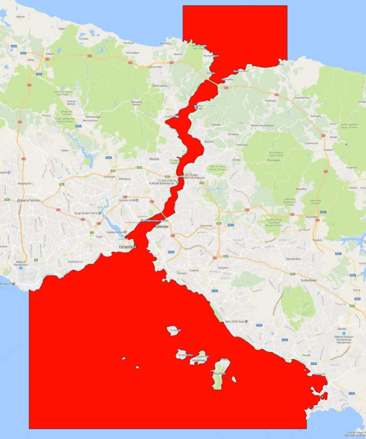
| Environment Name | Straight of Bosphorus |
| Content Name | Bosphorus |
| Country | Turkey |
| Continent | Europe |
| Chart Cells Used | TR401811, TR402921, TR402923, TR502920, TR502929, TR52921A, TR52921B |
| Chart Version | Week 6 – 2016 |
| Geo-Center LAT | 41.092471 N |
| Geo-Center LON | 29.045538 E |
| Northern Limit (TOP) | 41.3135 N |
| Eastern Limit (RIGHT) | 29.2894 E |
| Southern Limit (BOTTOM) | 40.7596 N |
| Western Limit (LEFT) | 28.8017 E |